Awakening Sleeping Giants – Corriegills Forms

Travel to the Isle of Arran, from the River Clyde, south past the Isle of Bute to gain a different perspective on the Firth of Clyde. It highlights, how past people may have understood the seascapes of the lochs and rivers of this part of Scotland, through longer journeys. For those able to travel across moody waters, dangerous: yet when returning with rare materials and stories of different places, empowering.

For the past few years I have been encouraging collaboration on the research of the Neolithic of the Isle of Arran but set in a wider context of how its megalithic sites can be related to Ireland and Orkney. As well as it’s remarkable archaeological heritage, Isle of Arran is also renowned for its geoheritage – from Hutton’s Unconformity to Dinosaur Footprints there is much to see.

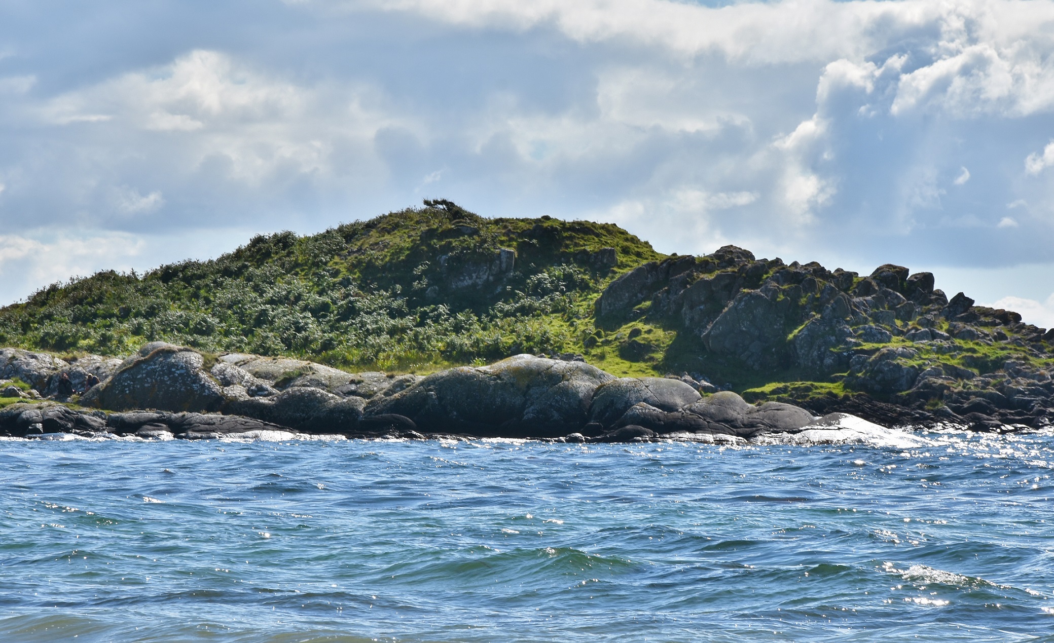
What brings the stories of Arran’s archaeology and geology most sharply together is the role of pitchstone. The only significant source of volcanic glass like material in Scotland, it was used by people from at least the fifth millennium BC for the production of sharp edged tools. During the fourth millennium BC, people exchanged pitchstone across much of what was to become described as Northern Britain. Best known among the huge range of locations of Pitchstone on Arrran is Corriegills. According to the Book of Arran, Corriegills may relate to Norse words, Korfa (Raven) and Gil (Gulley). Situated to the south of Brodick Bay (derived from Norse Broad-Bay) and Lamlash Bay (the location of at least two Viking Age burials), Corriegills runs below a range of crags and raised beaches. For 30 years I thought I knew what to expect when I visited this location – the site of ‘Neolithic Quarries’: a neo-industrio-complex of value extraction, a node of desire and dispersal. I expected quarry faces and spoil heaps – and yes, if you seek the, they may be present.

Yet once again I was surprised.

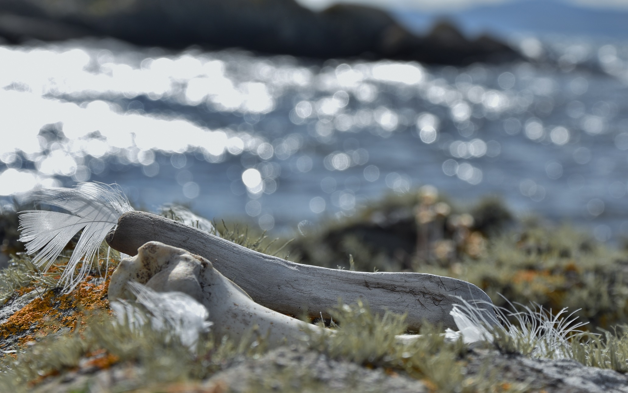
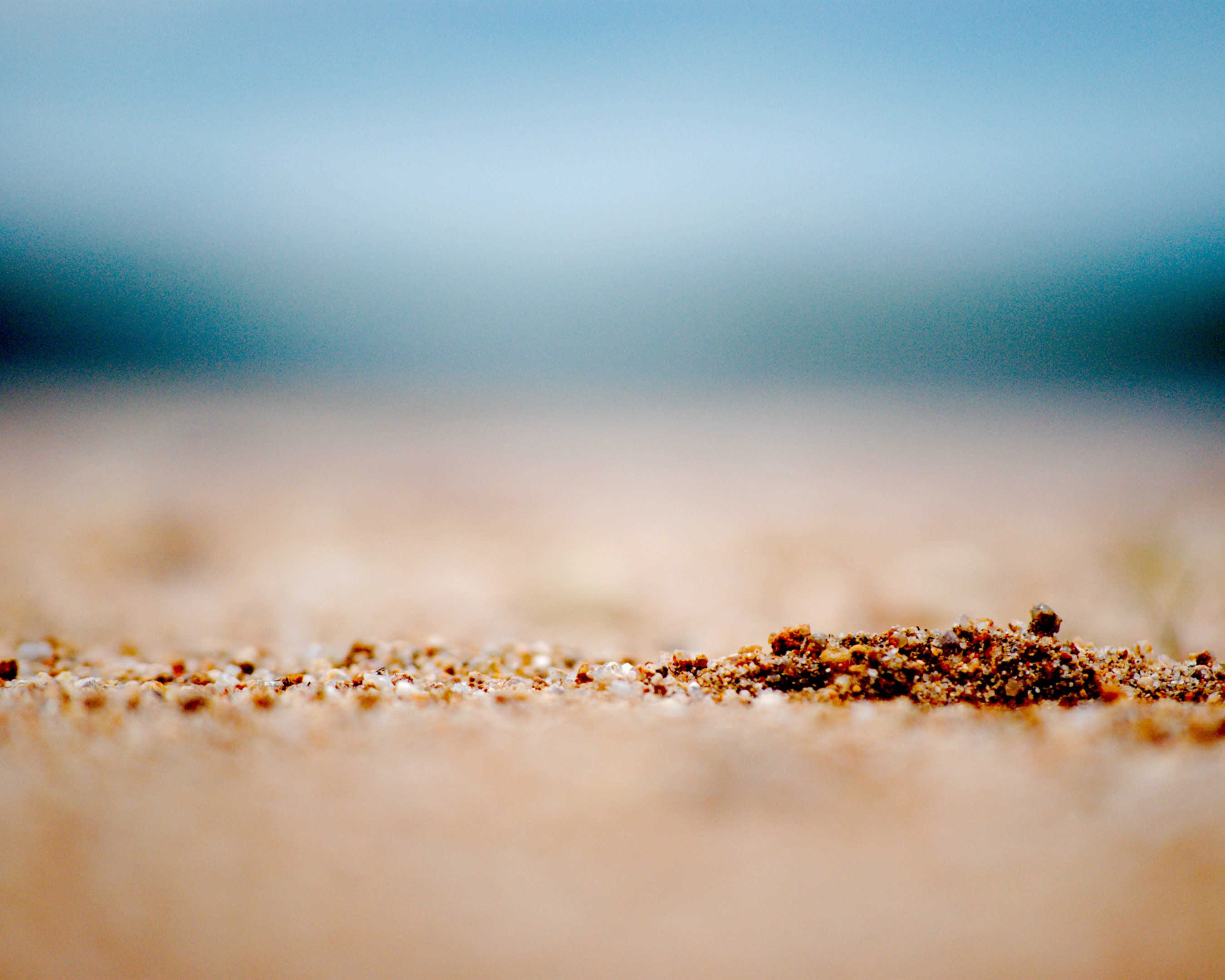
Dark shattered glass hiding in the shoreline grasses,

an arched dark spine glistens:

suddenly imagined panther-like form, hunting Goat Mountain.

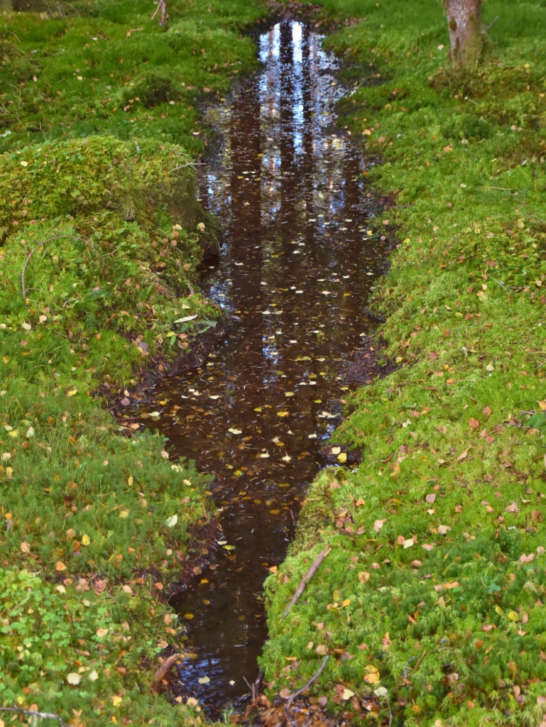
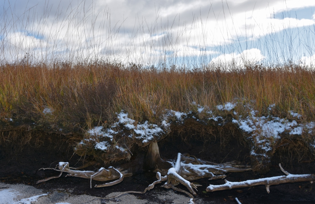
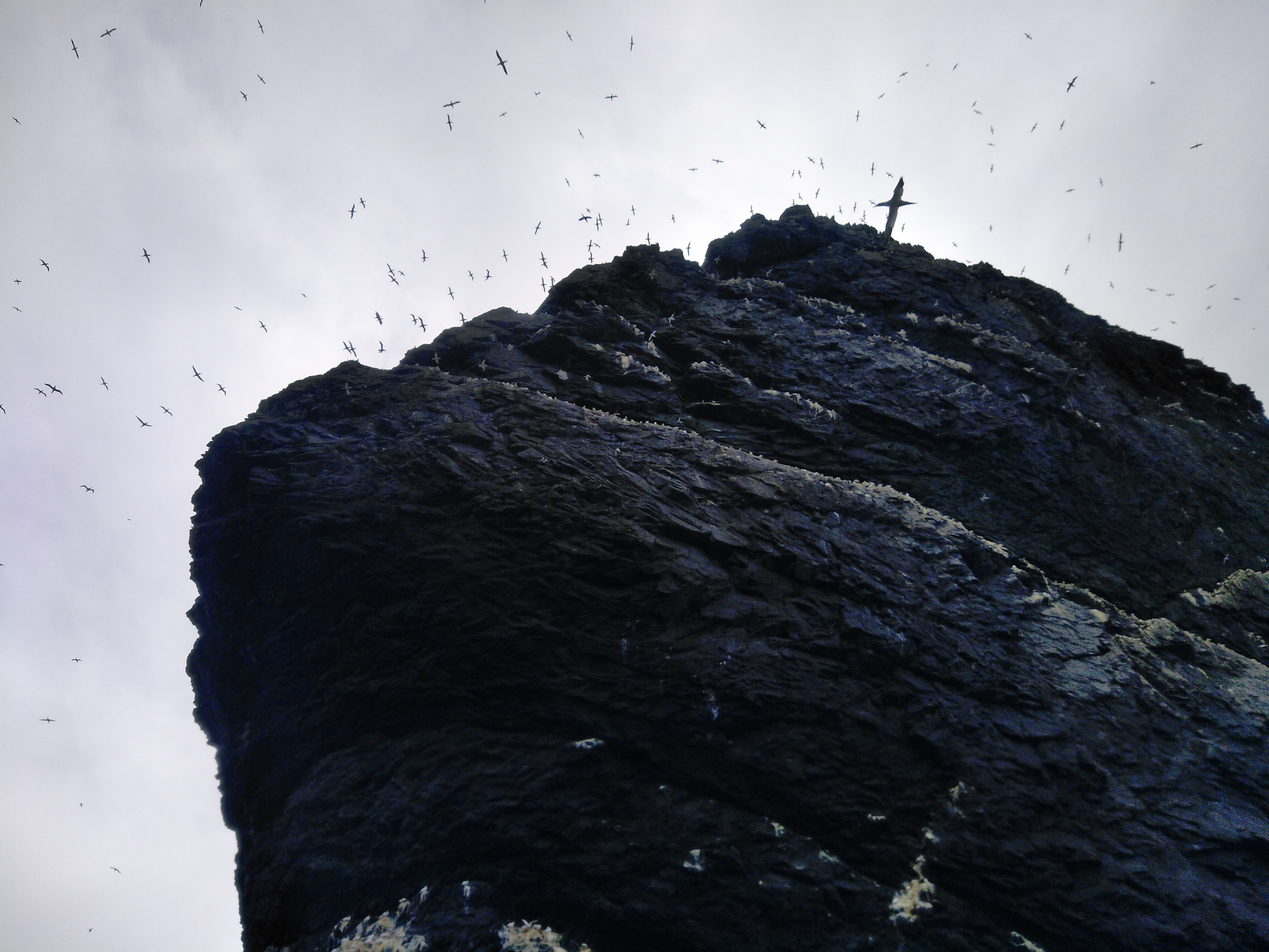
Travel further towards the headland, Clauchlands, looming above is the hillfort of Dun Fionn. As you approach the headland, the slopes covered in sea storm distorted birch and hazel, the old red sandstone shoreline has been sculpted.

Along precarious coast, there are marks of meaning which resonate through the millennia.

Between the green algae coastal pools, pock marked face, dimpled, cup-mark forms – along the sea eroded stone ridges. To the casual archaeologist, a remarkable assemblage of rock art. There was no mistaking these simple metaphoric forms.

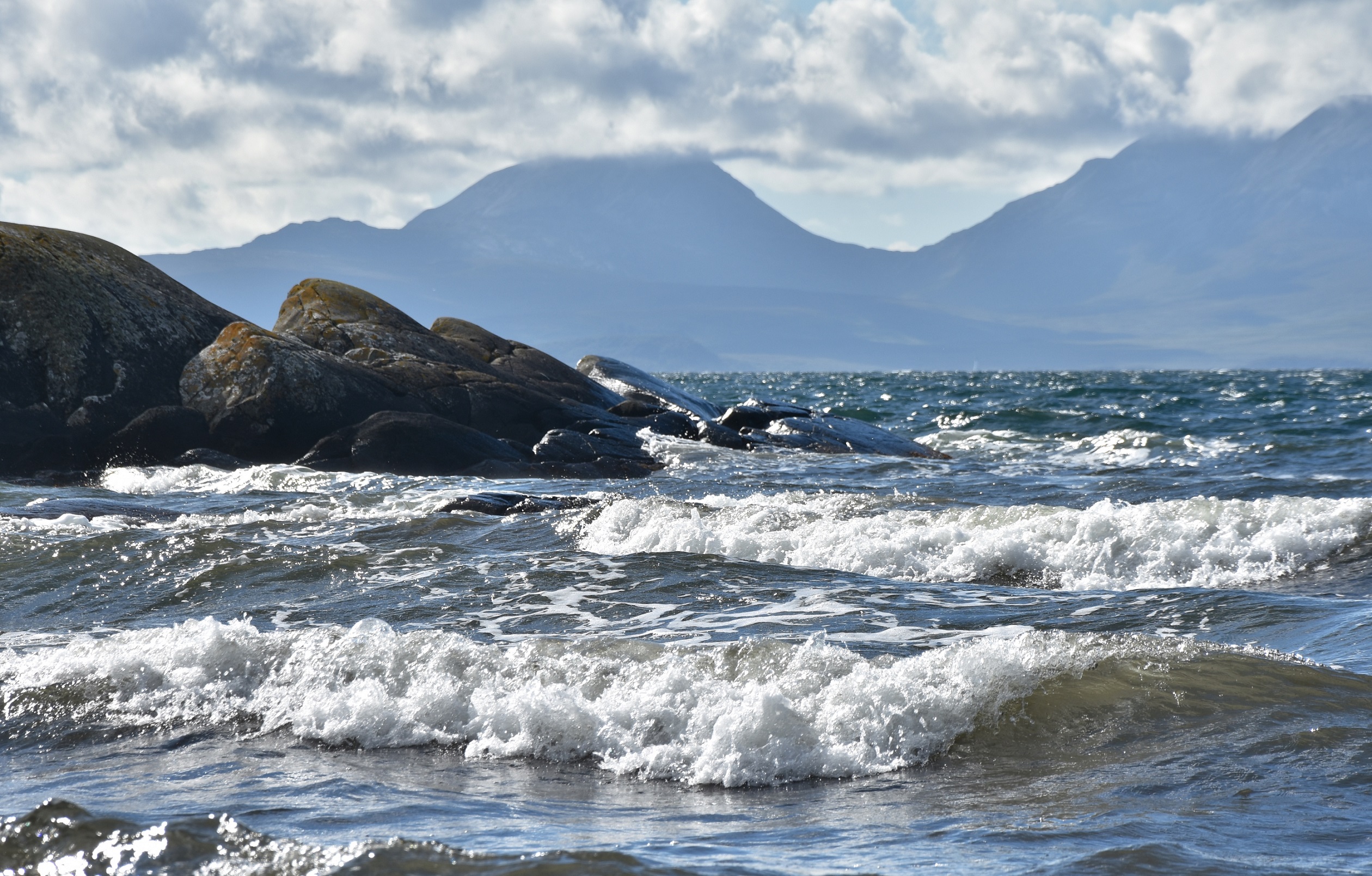
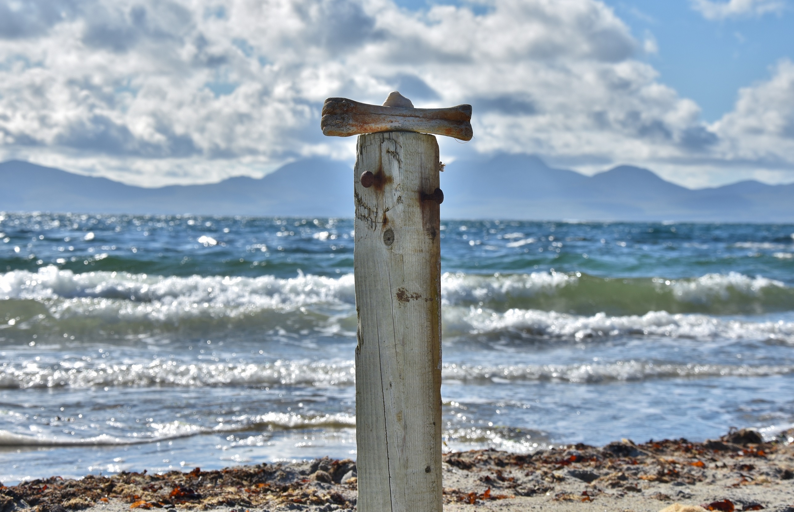
As the shore narrows, the eye is drawn to an upright stone – monolith, it russet form resting upon two large black pitchstone boulders. Then turn, find different perspectives – distant mountain, Goatfell, calls the eye. Yet look again,

see how the foreground changes everything, when Corriegills form reveals,

Awaken, Sleeping Giant.

————————————————————————————————————————

I will leave others to judge, such as the experts with Arran Geopark, whether this stone has been worked to create a head like form or whether it is a natural rock splitting phenomenon encountered by my Pareidoliac tendencies. More important perhaps is when this form was first created and / or recognised: I doubt this is the first time it has been woken.

In one scenario, the head may be a fanciful relatively recent addition to the shore line. In another, it may have been created, with suggestion of helmeted form, to watch the seascapes of the Firth of Clyde, perhaps bearing witness to Norse longships. Or is it possible that when people traveled to this shore to gather pitchstone that this face was already present?

One thing is sure, with Climate Change, this giant will witness major changes over the next few generations – I wonder what it will do now it has been woken?

For some more interesting stone heads in the Clyde Region have a look at this earlier blog post: Borne of Stone

For more information on Pitchstone sources from Arran, there is a good Scottish Archaeological Internet Reports article by Torben Ballin and John Faithfull.

And again, should we wash upon, Loch Awe shore …

Vicarious serendipities, perhaps, could have only ever occurred at this location?

It started with a couple of images from 1970. I would encounter them once every few years or so, but they haunted me over several decades. It may not seem like a significant rhythm, too irregular, unpredictable, to have any substance? But like a slow burning ember, which with the slightest breathe of air can briefly flash bright before returning to dormant slumber under ashy coat, the potential to fully ignite remained. Each time I saw the images, it was always like being reminded of something I had forgotten, but couldn’t remember what or why!

Many times before I had driven along the shore road, glimpses of tree covered islands, crannogs and unsettled water, no more than fleeting impressions. And then I found myself, on a hill side overlooking Loch Awe for several weeks. From here the stone husk of Kilchurn Castle provides a vivid reminder of the history of Scotland’s landscapes: a favourite picturesque centerpiece, providing seductive views for quintessential yearnings of Scottishness.

But looking down, with different perspective, hands covered in peat and mud, trying to make sense of the Medieval period from broken fragments, I wondered. Wondered why Beuys responded to the shore side and what motivated him to create such a humble sculptural piece.

It is said that a lump of peat, length of pine branch and copper pipe were discovered by Beuys on these shores. These were combined, crozier like, and placed in a lead vitrine, to become ‘The Loch Awe Piece’. Perhaps it deliberately presences the symbolism of early Christian missionary regalia, tangled with the shepherd’s crook, both of which changed this landscape physically and conceptually.

But what I struggled with was the discovery of the copper pipe. Peat and pine expected, the vedigris tube troubled me, and I didn’t know why. So I resolved, to revisit, to return to the 8th May 1970.

I carried further expectations of the shoreline. Remote(ish), relatively unvisited (a few roadside stopping places are hasty insta-locales), slight and fleeting this should be a place of little trace. And the dirty truth, where water washes, we expect our detritus is tidied away, like some debris removal ecosystem service. And so, I found myself on the shores of Loch Awe, naively surprised at the rubbish. Camping gear residues, fishing tackle tangles, barbecue libations, carbonised outdoor activities, all evidenced from fire pit scatter patterns of objects.

But then there was another range of materials which I doubted anybody would bring camping, broken window handles and tools, more akin to dumping of materials from a house refurbishment. It felt like a forensic archaeology of the anthropocene, almost unnoticed, an aggregation of tiny acts of aggression littered the shoreline.

Such patterns of behavior have perhaps accelerated since May 1970. With a fifty year period of marketing frenzied consumption, crashing willfully across our shores. So it was now no surprise that, among the broken bits of screw driver, handles and cans, a copper pipe had once been discovered here. No caring crook or inspiring crozier but a length of domestic waste sanitation.

So I gathered and crafted, to bear witness perhaps, to the unintended consequences of our material entanglements. A trophy of our times, hybridized bio-mechanics, as anthropocene assemblage. And when you look in its quartz eyes, do we see death or a feint flicker of hope?

I can’t help wondering, fancifully, is there now a moment on the 8th May 1970, where my faint spectre like figure can be briefly seen, perhaps out of the corner of Beuys eye, purposively scouring the shoreline.

Perhaps decades of glimpses of Beuys accreted, with other moments around the shores of Loch Awe, like some plastiglomerate, which could only have occurred in such anthropocene times. Perhaps in such times we need to find new aesthetics, beyond the picturesque ?

And are there other places you know, where we need to be sensitive to spectres of the future haunting us?

————————————————————————————————————————–

I wonder, why should this matter in times of environmental and climate crises? Perhaps an archaeological sensibility to the anthropocene (its origins, manifestations, asymmetries and more-than-human entanglements) could be important at such times? Could an #AnthropoceneArchaeology #ContemporaryArchaeology which reveals and challenges our assumptions about how and why we consume be a vital component in adaptation and resistance?

On 8th May 1970, Joseph Beuys traveled ‘the Road to Meikle Seggie’ through Argyll, Scotland, with Richard Demarco and Sally Holman. Some good accounts of Beuys work in Scotland can be found in Richard Demarco & Joseph Beuys A Unique Partnership published in 2016 by Luath Press and Joseph Beuys and the Celtic Wor(l)d by Victoria Walters

The two images of Beuys have been created through rephotography at the closest location I could find and merging with the originals held in the Demarco Archive, which can be found in the Argyll Demarco Archive Folder.

All elements of the piece, apart from the pins, were found on the shore of Loch Awe. It was produced for the XR Summerhall 2019 Exhibition and was accompanied by a short performance and discussion about Anthropocene Archaeologies. My thanks to the XR Summerall team for accepting my work, particular thanks to Natalie Taylor, Johnathan Baxter and Felicity White for support. I have also been privileged to work with Clan Gregor and Dalmally Historical Association, and all the wonderful volunteers who participated, in the investigation of a Medieval settlement overlooking Loch Awe and through many years of archaeological excavations in the area have learned a great deal from all those who are so passionate about the heritage and landscapes of Glen Orchy, Glen Strae and Loch Awe side. Such archaeological encounters have also informed the work: And Again, Should We Wash Upon Loch Awe Shore …

Dark Enchanted Isle

The small ferry left Stromness as the storm began to rise. With the distant island mountain already backdropped by troubled skies and foregrounded by rising waves, it struggled to land briefly at Graemsay, spilling out people and packages hurrying to avoid the incoming tempest.

By the time we arrived on Hoy, cloud and rain was racing angrily towards the shore. I zipped my waterproof tight, stooping, rain driven into my face by an unforgiving wind I began to make my way uphill through the storm. With an hour or more walk along the old moorland road to Rackwick, I had resigned myself to being soaked by the time I reached my destination but began to worry about the practicalities of pitching a tent in these conditions.

And then a white van pulled up, surprised and slightly confused I hesitantly opened the door, to find a black and white collie sitting on the seat. ‘I was looking for you’ said the driver ‘Its not a night for walking’. With this kindness, I arrived at Rackwick somewhat sooner and drier than I had any right to expect.

Sea cliffs, funneled foam and fury, into the bay. Swollen waves, crashing against already saturated shoreline. Imagining scenes of chasing my tent, tattered though the night, any thoughts of canvas was abandoned, and I turned to the Bothy.

* * *

The next morning I stood between Trowie Glen and the Nowt Bield Corrie. The names reveal something deeper about this place. Trowie is an Orcadian term, derived from Norse, for Troll: important folklore and literary figures often associated with particular mounds or distinctive stones. While Nowt Bield, I think means nothing built, evoking a harsh and inhospitable character but place names can be fickle and subject to change. The Ordnance Survey name book of 1879 shows the burn was thought to be called the Burn of the Horned Bull but was crossed out and written as Burn of the Nowt Bield. Perhaps the cartographic slaying of a sacred bull?

There had been sightings of the sea eagle chick at this location. Now old enough to be left by its mother, I watched it hunt tentatively, more of a hop and glide, than a majestic soar. But this vulnerability was humbling to see, a more elemental being still learning the power of the air. It seemed appropriate it was this location, hovering between sacred bull and sleeping troll.

Perhaps five thousand years ago, people cut into a massive boulder slab, creating a short passage to a small chamber, off which are two smaller cells. The entrance had been blocked, and probably remained so for perhaps up to 4000 years, till about 1500 AD.

The Dwarfie Stane, as it is now called, may have been used for mortuary practices, with fragmented human remains being, probably temporarily, kept within. Elsewhere on Orkney, bird and animal remains have also been found in chambered cairns, perhaps showing that the rites were more complex than burial as we would understand. For example, at Ibister the remains of 14 sea eagles were also present among the bones of people.

Entering the Dwarfie Stane is a slightly claustrophobic experience but sealed in stone, the eyes and ears quickly attune to different spectrum. You can’t help but wonder who entered here and what activities took place. I lay down for a while, shrouded in stone, and let my imagination drift.

As I left I wondered what changes occur

when you emerge from a sandstone cocoon?

As well as cartographic concerns, the Dwarfie Stane was increasingly in the 19th century consciousness: referred to in Walter Scott’s 1822 The Pirate; with the Geologist Hugh Miller having carved his name in one of the cells in 1846; and on the outside carved in 1850, backwards in Latin, the name of Major W Mouncey, accompanied in Persian by ‘I have sat two nights and have learned patience’. Beneath these recent accretions of ‘men making marks’, there may be a Norse inspired Medieval folklore of Trolls. But there is a deeper horizon which can still be encountered here.

The Dwarfie Stane lies on a slope below a striking cliff line, now called the Dwarfie Hammars. The cliff line is pocked with regular indentations where the rock has split and tumbled down in blocks. Caves have also been discovered on the cliff face, in one of which a polished stone was found, suggested as perhaps akin to some prehistoric artefact.

The tradition of sky burial is known in many cultures, with bodies being exposed, to deflesh through elemental wind and rain and carrion beak. There are also many traditions of using such cliff faces, and caves or ledges, as the site for burials or ossuaries.

I now want you to imagine, people moving carefully but confidently (well used to collecting sea bird eggs) along the cliff face. There may have been cloth or hide banners hanging down or totems erected at points marking the entrance to particular caves. The cliff face may also have been covered with bags of bones and baskets of skulls, looking down at the Dwarfie Stane.

Now smell the smoke and distant sea spray.

Can you hear the songs and chants?

From up on the cliff, with the call of the Sea Eagle still higher, you would have views to the north and east to Mainland Orkney and to the west to the setting sun on the north side of Rackwick Bay.

And on days, when the banners flapped and bones rattled above with the fury of the elements, and you stood at the Dwarfie Stane you knew you were truly alive.

————————————————————————————————————————–

Upon reflection I wonder why this matters, why these enchanted places are important in such troubled times. Perhaps it is they remind us of other times and ways and extend the possibilities of what we can work towards in the future? Our relationships to those who have gone before us, the terms we use (? ancestor, family, stranger, people) are powerful components (at least implicitly) of many contemporary debates about identity and politics. Our death cultures also matter: the way we treat our closest at times before, during and after death, how we celebrate and mourn are also fundamental aspect of cultural practices which over centuries became increasingly individualising and corporate. While there are all kinds of legal and ethical issues, at least knowing there were different mortuary and funerary practices, I hope cultivates awareness, sensitivity and respect for the variety of human and more-than-human life ways too.

For more Inspiring Island Explorations,

please have a look at some other HeritageLandscapeCreativity posts:

Imaginary Island of Ailsa Craig

Witches Whispers of St Kilda

Hoy has a remarkable series of stories of people and its landscape. Thanks to Antonia Thomas and Dan Lee for some great advice and information before my journey to Hoy. I greatly appreciated the kindness of Jimmy and Diesel and the stories shared of the Dark Enchanted Island.

The title of this post refers to the book Hoy, the Dark Enchanted Island by John Bremner – which alas I was unable to get a copy.

If you are lucky enough to be able to visit Orkney, rather than dash from monument to monument in peak season across the World Heritage Site, visit other Islands rather than just Mainland Orkney and if you can, please go out of peak season when the weather is wilder.

#SlowArchaeology #WildPrehistory

Thracian Dreamings

Months later I still daydream in Thracian,

Albeit, fragmented glimpses, a light,

Almost imperceptible, awareness.

But I still find myself wondering,

About sky temples and sanctuaries,

Among juniper scented mountains.

————————————————————————————————————————–

I started Dreaming in Thracian due to an Erasmus+ study trip to Bulgaria. A short report on the study trip can be found here: Glimpses Of Thracian Landscapes

Many thanks to Archnetwork for organising the Bulgarian trip and to our hosts at the Devetaki Plateau Association for such an insightful experience.

On both a professional and personal level the opportunity to take time out and learn was immensely valuable. There will be further exchanges in 2020 by Archnetwork about which more details can be found here: 2020 Archnetwork Destinations

In 2020 cultural exchange and shared learning may be more important than ever to help respond and adapt to some of the great challenges we currently face. If you work in the Natural or Cultural Heritage sector in Scotland I would highly recommend undertaking an Archnetwork study trip: you may start dreaming differently after.

Ghost Pines


rooted

Hush land scape listen,

absence on wind

do we hear, gentle rustle.

rustle

stand

Fresh pine stand christen,

presence in land

do we smell, needle bristle.

sentinel

dismal

Mulch hide shape risen,

substance of plant

do we taste, peat dismal.

substance

mulch

bind

Wash Loch water glisten,

disturbance of bind

do we feel, rooted sentinel.

disturbance

wash


About 4000 years ago the climate became cooler and wetter, the Scots Pine (Pinus sylvestris) struggled to cope, essentially its roots suffocating, and died back.

The fallen trunks and tree roots became preserved within the forming peat.

These skeletal remains are found in remote places like Rannoch Moor, Scotland.

Once witnessed, the wider landscape appears haunted with Ghost Pines.


Amulets, Charms & Totems

Talisman Reveries

Some places distinguish themselves,

first glance,

part curve & coastline roll,

nothing more,

still, slow

lift the veil

Rubha na Caillich

glimpse deeper,

feel texture, smooth unique forms,

practice geological crafts,

caressed ocean rise & fall

Bather

torso twist & turn,

with millennial restlessness,

some settle,

Congregations

in slumber,

life-form

aggregates,

flocks, herds, names & stories

Flocks and Herds

hover, rest, soar & plunge,

surge in your liminality,


flow land & sea

Cailleachs

sinuous figure,

washed & soothed,

rise paps,

taste cloud & rain

Sentinels

rest upon her

sanctuary

with gifts returned

Offerings

dive deep


seek


macabre collections,


offer chitin charms

share exoskeleton

amulets

Paint box  1.JPG

upon her flanks,

now she bares

palette pools


yellows,

browns

&

greens


mix & wash

Seascape

with cumulus brush

cyan coating

maritime hues

Recline

in time

we can drown,


draw down,

Submerge

wash & wave

Paps of Jura

escaping

solar bleached

realities

Enchantment

before

winters

first flurries

Feather Flight

with

gentle

poise

discover

new

totems

Totem


The distinctive point, Rubha na Caillich, is a weathered rock outcrop on the coast of the Kintyre peninsula.

To the north, the seascape soon leads to the Corryvreckan (Cauldron of The Plaid) Whirlpool,  where it has been said the Caillich washes her cloth at the end of Autumn and when cleaned becomes the white winter snow covering the land.

To the east, across the Sound of Jura, are the Paps of Jura (Beinn an Ã’ir, Beinn Shiantaidh and Beinn a’ Chaolais)

Immediately, to the south of Rubha na Caillich, is Dun Cragach, where a small community dwelt beside the Caillich figure about 2000 years ago.  I am sure they would have recognised the distinctive form next to them and would in some way have incorporated her presence into their ceremonies and stories of the landscape they inhabited together.

They would have also interacted with the other birds and animals of the landscape, with perhaps different perspectives from today : how they understood, otter (or diving sea birds), who brought sea urchin and crab to eat on her flanks, leaving exoskeleton amulets, would be fascinating to explore further.

Travel south a further kilometer and you reach Carraig nam Bodach but that is another journey together.


Witches Whispers

St Kilda Beach

Despite it remoteness, St Kilda, is globally connected.

St Kilda Village

Through shared histories, oceans and skies

St Kilda Airport Lounge

with flight                                maritime transports                          we congregate

nearly 1 million birds

Northern Gannet, Atlantic Puffin, Northern Fulmar, Manx Shearwater, Storm Petrel, Leach’s Petrel, Kitiwake, Guillemot, Razorbill, Great Skua

summer

at the archipelago

Hirta, Dun, Soay, Boreray.

St Kilda Seabird

Remote Life

Collect Bird

Cleit Dry

Boreray Wave

Yet we wont linger on Hirta but head to the world of Boreray

Boreray Revealed

Through

wave

wind

Boreray Splash

and wonder

Boreray closer

we reach

Stac Lee

Stac Lee

look back

Hirta

with anticipation

St Kilda birds

before crossing

beneath

sea cliffs

thrumming

krok krok krok krok krok krok krok krok

krok krok krok krok krok krok krok krok

krok krok krok krok krok krok krok krok

soaring

Flight

sweeping

crucifix

Flags

filled

vision

Teaming Skies

wards

Residues

pulse of the world

Nesting

receeding

Brooding

further

Seascape

from

Depths

memories

Archipelago

navigate dangerous waters

Navigable

voices voiceless

witches whispers

Fortress

kroK kroK kroK kroK kroK kroK kroK kroK kroK kroK kroK kroKk roK kroK kroK kroK

Stac An Armin

‘a great noise like that made by a gannet,

but much louder when shutting its mouth’

Stac an Àrmainn

‘A storm rose, and that, together with the size of the bird

and the noise it made led them to think it was a witch.’

Stac an Àrmainn

‘they were beating it for an hour with two large stones before it was dead’

Torment

‘he was the most frightened of all the men, and advised the killing of it.’

Rupture

‘they killed the bird on the third day after it was caught’

Regret

Can we ever leave

the world


of birds and witches,

St Kilda Stac Lee Boreray

now unclear

which is which,

St Kilda and Stac Lee

Bird as person,

bird sustains life

person as bird.


The collection of eggs and hunting of birds provided a significant amount of sustenance to those living on Hirta.  Stone shelters, Cleits, were built and used to air dry the birds for consumption later.  Climbing cliffs and seasonal stays in bothies on the archipelagos other islands and stacks to hunt was part of the strategy for sustaining life.

Stac an Àrmainn is the highest sea stack (196 m) in the UK and is the location of at least two powerful tales.

One tells of the group of three men and eight boys from Hirta who were stranded here in 1728 for 9 months.  Upon returning they were to find that during their absence most of the community had died, all bar 4 adults and 26 children, from small pox.

The second tale, from about 1840, is of the death of what was probably the last Garefowl (Great Auk) in Scotland, when three men allegedly thought it to be a witch, only a few years before the species became extinct.

The quotes above are details of the St Kilda witch account, taken from a letter by Henry Evans, and can be found in:

Harvie-Brown, J A 1888 Vertebrate Fauna of the Outer Hebrides p 158-59.

How faithful the details of the story are can be debated but there was certainly a strong folklore which may have provided a context.  An interesting overview of witches can be found here:


and a broader context can be found here:

Campbell, J G 1902 Witchcraft and Second Sight in the Highlands & Islands of Scotland : Tales and Traditions collected entirely from Oral Sources. Glasgow.

Seeing a Great Auk in Scotland in the first half of the 19th century would probably have been a rare occurrence, numbers already depleted, and with the last small colonies on Iceland some distance – so there may have been no familiarity with this species of bird among the men on Stac an Àrmainn.  Whether the killing of the last Great Auk in Scotland as a witch (presumably in a shape shifted form) is true or not, today we are faced with the certainty if we do not do things differently other species will become extinct and St Kilda and the wider world it represents will be poorer for such losses.

How will we explain to future generations, what will undoubtedly seem 170 years in the future as, unjustifiable behaviours which lead to such losses.  Seemingly enlightened, we may not fear witches, but through our behaviours we make our offerings to other gods of consumption and waste.  They may not be so overt but our brutalities can be small, long  and incremental.

Listen for the whispers….


I was privileged to journey to St Kilda earlier this year with the wonderful Kilda Cruises a great highly knowledgeable team.

For more details about St Kilda, please visit, the National Trust for Scotland website, the St Kilda website  and the UNESCO St Kilda World Heritage Site

If St Kilda is not possible for you, another option to consider is the journey to Ailsa Craig, some details can be found in another post

Imaginary Island – journey through the south west.


Through the Eyes of the Ballachulish Goddess

The Ballachulish Goddess was discovered in 1880 beneath about 10 feet of peat.

When she was lifted from lying face down,

her quartzite pebble eyes stared forward,

unwavering.

How remarkable it would have been, when she was first lifted to gaze upon her, or rather for her to see again, to gaze upon us, for the first time in over 2000 years.

ballachulishfigure-originalphoto

Whether deliberately so, her eyes seem different.  Her larger right eye appears to have a distinct pupil marked, as if staring directly at us, or forward into the distance. While her small deeper set left eye, evokes an inward contemplation, perhaps a second sight to other places and times. Her mouth appears poised, as if about to speak to us, perhaps of some wisdom from the past or I can almost hear the first notes of a song emanating.

Taken back to Edinburgh, she was uncared for, and as she dried out, her fabric twisted and split, presenting a countenance which differs greatly from her appearance of 2600 years previously.  Now a look of shock, or worry perhaps, a permanent rigor mortis – her eyes pleading to be freed from permanent public display.

ballachulish-figure2

Many have speculated, who she is and what she may have represented.  Others have noted that the location she was left was a special place, next to a narrow water crossing, the successful navigation of which allowed travel on land up the west coast of Scotland.

DSC_0526

Some have noted, with the proximity to Beinn a’Bheithir, that the Ballachulish Goddess may in some way be related to the Cailleach Bheithir.  Described by some as the winter storm goddess, responsible for sudden changes in weather, which even in April with snow in the corries and successive bands of icy rain sweeping across Loch Leven still seems within the Cailleach’s purview.

DSC_0524

I cannot contribute much to the story, like many before I wonder who she may have represented – an individual, an archetype, a goddess, named or nameless – perhaps all these at different times.  However, I can reflect on the landscape she was found within and how earlier sites may reveal something of her nature.  Other archaeological sites including cairns and burial cists suggest this part of the landscape had been used for ceremony and ritual by people in the third and second millennia BC.  So the Ballachulish Goddess was located in a landscape which had a depth of story before she was created about 600 BC.

The location where she lay beneath peat for over two thousand years is on the brow of a raised beach.

IMG_20170404_114026IMG_20170404_113900

IMG_20170404_113851

A shore line, when following the last ice age, sea levels rose rapidly and water lapped many meters higher than today.   However, about 600 BC that raised beach line was already a distant memory and much of the ground below had been revealed by falling water levels.

IMG_20170404_113838

Where she stood, she looked over a small islet An Dunnan. When the water lapped at the raised beach line where the Ballachulish Goddess was placed An Dunnan would have been totally submerged. By the time the Ballachulish Goddess was actually placed at the raised beach An Dunnan had been emerging for several thousand years.

DSC_0501

Others before had marked these profound changes. On this islet, there is a small group of cup marks, a distinctive form of rock art dating from the the fourth millennium BC.

IMG_20170404_115046

DSC_0497IMG_20170404_115016

As the water retreated and the island became accessible, perhaps a thousand years later people modified the rock with cup marks.

IMG_20170404_115142

Most striking perhaps is that they are adjacent to significant outcrops of quartz, which even today seem to flow or drip into the sea below.   But in heavy tide or winter storm, they will be washed and partially submerged by the sea.

IMG_20170404_115033

Where the Ballachulish Goddess was located was not only liminal in terms of the distance across a short, but potentially hazardous, stretch of water.  The liminality was also temporal, a place of deeper time where sea and land played out a dance through millennia, as sea levels rose and fell, and then land sprang back up after the weight of an ice sheet lifted.

The Ballachulish Goddess stood poised above An Dunnan, with one of her eyes looking back to when people, perhaps two thousand or more years before had marked rocks revealed by watery transitions.

One quartzite eye staring back calmly at the quartz which marked this place of rock-water which had been birthed as the sea levels fell.

Yet as she stood on the raised beach, she also looked forward with another quartzite eye, to a time

when sea levels may rise again, and

the dance of water-rock continues.

——————————————————————————————————————————-
The images of the Ballachulish Goddess are from the National Museums of Scotland website where more information can be found.
Further information can be found at the Canmore
The original publication of the discovery can be found in Proceedings of the Society of Antiquaries of Scotland.
While further thoughts on the ritual context of the Ballachulish Goddess can be found in an article by Jeff Sanders  ‘The sky almost never falls on your head – why ritual rarely fails’
in
Koutrafouri, V G ‎and Sanders, J (eds) 2013 Ritual Failure. Archaeological Perspectives. Sidestone Pres
And a brief introduction to some of the geology of the wider region.

Among The Dead Dunes Some Trees Glow Like The Sun…


Among Dead Dunes

Primordial Arboreal Gold

Washes Upon Baltic Geographies.

Millennial Boundaries Shift

With Faint Traces

Of Ancient Rites,

Through Weaving Light & Shadow

We Can Glow Like The Sun.


I was privileged to stay nearly three weeks in Lithuania spending much of the time exploring aspects of its heritage and landscapes.  The first week was spent at the wonderful Nida Art Colony, a creative center from which I explored the landscape of the Curonnian Spit.   Located on the Baltic coast, the spit is about 98 km long, the northern part of which is within Lithuania and the southern part in the Kaliningrad region of the Russian Federation.  I was drawn back to the Curonnian Spit, in part due to my interest in a Neolithic amber hoard, within which are a range of unusual figurative forms, that had been discovered in the 19th century at Juodkrantė.

However I very quickly became more interested in a series of tensions and entanglements that the forested nature of the landscape and the elemental nature of amber began to reveal.  The Curonnian Spit has a remarkable natural and cultural significance in part recognised with its inscription as a World Heritage Site in 2000 and its status as Kuršių Nerija National Park and as the Kurshskaya National Park of the Russian Federation.  So interesting tensions can be encountered between geo-morphological forms, climatic processes and the movements of other species which do not recognise political boundaries and the management of designated landscapes.

The landscape of the Curonnian Spit has been subject to major changes in character, sea level, deforestations, erosion and drifting of sands, and then reforestation and management. People have responded for millennia, and in part caused, some of these changes. For millennia they have encountered timeless gifts cast up from the sea. At times they reworked these gifts, and sent them back, perhaps in an attempt to make sense of or intervene in the world of change around them.

While there I worked on a piece through researching the history of the landscape and those who have dwelled within it for nearly 5000 years and by creating a series of small temporary installations in the landscape. This resulted in the development of a piece Among The Dead Dunes Some Trees Glow Like The Sun which was performed the following week in Vilnius.  The 12 minute performance explored the ongoing inter-relationships between people and landscape, and invited us to re-imagine the way we interact in the future.   Rather than try to reproduce that performance here I show some of the elements which I responded too.

There Is An Equilibrium Here… ?

Five days and fifty miles I traveled by foot.

Narrating the journey, as a linear movement would be possible, but my experiences were more complex, more entangled, with a range of eruptions and encounters in the changing landscapes which continue to resonate.

Some sense of the journey may be gained, however, through the images below, some of which were incorporated in a joint exhibition held in Caithness, Scotland, in 2016.  Each image, a compound of particular serendipitous conditions, mediated by subsequent selective sensibilities, represents moments of revelation.  Brief entanglements, enchanted, with the rich flows of time and the dynamic inter-relationships between people, other species and landscapes.

The Flow Country, a patch work of Lochs and Lochans, stitched by burns and rivers, often offered views to the distinctive peaks to the south of Morvern, Maidens Pap and Smean.  These peaks guided my journey, topographic beacons, which drew me onward and inwards.

birdland

Bird-land encounters were prevalent, when I couldn’t see birds their song was ever present, even at night my sleep was disturbed by their ghostly clicks and calls.  Only once did bird-land go silent, during my last morning heavy rain confined me to the tent, but it was the energetic call of song birds which told me it was time to depart.

Before my journey commenced, I encountered the realities of the avian beach, where angels wings littered the foreshore : stripped of flesh, divorced pairs of wings, perhaps the work of skuas.  Five peewits mobbed a buzzard ; a heron leaving the Strath, frantically avoids being pulled down by gulls, its elongated body bending unnaturally in utter terror desperately dodging the beaks of kindred.

beach-dream

Stooping for water at Allt nam Beist (Burn of the Beast) there is a huge splash nearby.  I quickly turn to see an Osprey breaking from the water, a fish hanging from its feet, it ascends and turns to the south : I did not exist.

The loch is fringed with deposits of sand, beneath which is sealed peat, erosion reveals the stumps of ancient trees.  No arboreal fantasy but revelations of possibilities.  Moments later, fragments of flint, reveal themselves from where these deposits are being gradually worn by the gently lapping waters.  The forms of the worked flints suggest they were left by hunter-gatherers who also rested at this location, perhaps 7000 years ago.  We probably drank from the same burn, in which small fishes still leap to catch flies, and rested at the shores of the same loch : I almost heard the whisper of their voices.

Abandoned farmsteads in the uplands were prevalent, part of a  widely known story of the depopulation (the deliberate removal of people and change of landscapes) of Caithness and Sutherland, and much of Scotland.  Sheep played their unwitting role in this story, introduced by landowners, with landscapes and communities being re-organised in part to accommodate them on the land in the 19th century.  It seemed appropriate to sleep where the sheep had been penned, so for one night my tent nestled within a small sheep fold.

cotton-grass

The low red sandstone walls gave some shelter to the wind which whipped along the Lochside.  Then I wondered, it was a very small pen, perhaps too small for sheep.  Earlier inhabitations are also found in the uplands, hut circles perhaps four thousand years old, within which I think I slept.   I wanted to mark my brief dwelling at this spot, cotton grass, evocative of fleece, nestled in the cracks of the walls.

aumbry

Many of the longhouses (and shielings) have stone boxes built into the walls.  Aumbries perhaps for cool storage of foodstuffs, or safe display of treasured items.  Years later the soil reveals, the signs of former fertility, a flush of nitrogen, often ring such settlements, a sharp reminder of our loss : stinging nettles (Urtica dioica).

Those rich deposits can also be found in buildings which have been abandoned as sheep shelters – hard won ground, hard won places, lives and loves no more… !

hearth

Deer-land, dear-land, our-land.  For much of my journey I traveled through deer-land.  At first it was their multiple footprints, along shared tracks, least resistance across ground that you would sink deep in peat and water, still used by estates.  Then I encountered the herd, aggregations of stags and larger groups of does.  They watched, with flick of ear and rise of nose, my every move.  Brief silhouette on skyline, flash of white tail, gone.  A few watched longer, the last small groups of does and hinds, tenderness grazed patiently if I kept a respectful distance.  I continued to follow the deer paths, a different form of route along edge of river and burn, their path cutting more directly across loop and meander, a quicker more confident travel which I learned to trust.   One night I was woken by the grumph and roar of stags, so close it seemed they were next to the tent.

iron

Shelter can be found in these lands, a range of corrugated iron bothies, huts and boat houses.  Often a focus for hunting or fishing they are open to all who respects the spaces provided.  In some cases, a chronology of rubbish suggests it has been 20 years since properly used.  Brown rusted skeletal beds, and broken seats greened with age, a reminder of comfort and company long afforded by such places to those who make the journey.

bothy

A tradition of visitation was marked upon the wall of the few I visited, written in pencil, etched in pen and scratched with pen knives, a stratigraphy of dates and names going back to at least the 1930’s.

marks

R Hendry 11th May 1931 Killed Fox Last Night – there is a reality to this landscape, foraged, browsed, managed and changed with time.

My preconceptions of the Flow Country as empty lands was being challenged by the encounters, with the liquid landscape, I could only readily traverse where others had created track and bridge.  Many of the burns were wide and deep enough that a bridge was needed to cross, and if not maintained routes will shut and landscapes become less accessible.  In one case, I balanced precariously, with a full pack, on old railway sleepers which were the only remains of the long gone timber bridge.  Upon which I couldn’t turn back and if I continued was likely to take an early bath.  They bounced and swayed as I slowly edged over, not believing I actually made it to the other side.

bridge

Lichen colonises wood-land above peat quenched waters. They lead us to places of contemplation.  The aggregation of the fishers bothy, the curation and discard of meaningful journeys.

assemblages

Around the huts, slowly sinking into the peat, clinker hulks rotting on the shores of distant lochs.  Small rowing boats, in the main, but evocative of the sea and a wider tradition of boat building.  Rose headed copper rivets, copper nails, plank and cauking, paddles and playful catch.

clinker

For a moment, upland water, settles on the hull of the boat.  I drift, carried on the thermals, dip and rise like the cycle of the swifts, and soar in the gyre.

copper-nails

Woodland disappears beneath peat and the hooves of herbivores. I flow, return to the source.

clinker-beach

We are riveted to the changes of the foreshore, inescapably we are bound to the cycle.

sand

Imagine if we should be able to see worlds in grains of sand…

—————————————————————————————————————————–

In July 2016 I walked solo from Thurso on the north coast of Caitness south, through farmlands and into the watery interior of the Flow Country. Camping for four nights I arrived five days later in Dunbeath. The walk was my approach to developing content for a joint exhibition, with Ian Giles and Andy Heald, at North Lands.  It resulted in a series of photographic prints, texts and sculptures by me which responded to the encounters.

installations

Thanks to Dunbeath Preservation Trust for kindly providing accommodation at the Old School House in the days before and after the journey.  Many thanks to North Lands for their support and to Andy and Ian for the collaboration and companionship to produce the exhibition There Is An Equilibrium Here…

Monuments to the Future

Flipped

Stonehenge, imagine being there, about 5000 years ago, when people first started building the earthwork enclosure.  If you could linger, perhaps five hundred years later, you may have witnessed the first stone circle being erected.  If you were able to revisit in another two hundred years time, you could have helped remodel the monument and created the unique arrangement of hanging stones which are celebrated to this day.

Earth Avenue

Yet, it is easy to focus on the construction, physical representations of a will to transform, and overlook the long moments of reality when monuments were actively used. Monumental statements (fetishistic moments of monumentality) sit comfortably with contemporary concerns for master plans and iconic buildings : architect-planner-deity.    Perhaps monuments such as Stonehenge, dangerously legitimise the short term political gestures (remember the difficult birth of the Millennium Dome !), grand projects of great people, and as such belittle the everyday, annual or generational uses of places we value?

Mounds

So it is with interest  I have watched over the past few years the emergence of a new complex of stones at Crawick : which if witnessed by the monument obsessed archaeologist of the future could readily, mirroring contemporary archaeo-parlance, be described as a ‘monumental landscape’ but in the absence of overt function be easily classed as a ‘ceremonial landscape’ or ‘ritual landscape’.  Yet Crawick is of its time, as post-industrial imagineering, an overt expression of regeneration, a cosmological dream beyond the short half-life of industrial decay.

Industrial Shadow

A solution to the problem of the blasted legacies of open cast coal extraction.

Terraformed

Emergent

New Mound

Imagine

So again, like Stonehenge, we are encouraged to focus on the monumentality of the project, the grand vision of the architect god.  Yet it may represent a moment in time which is worth studying, as a contemporary archaeology, as an unfolding of possible futures.  Crawick landforming (phase 1) completed 2015, how will decades and centuries of humanity respond to this new space ?

Wandering

Our opportunity is to engage in the moments between monumentality : phase 1 completed 2015 and Crawick landforming (phase 2) due to be commenced in 2215 !  What potentials lie in new birthed spaces, what opportunities to explore and express in the longer flow of time ?

So perhaps at generational monuments like Stonehenge, what sang through the ages, was the joy of the use of the space, dance and music, life and death transforming to place.

Perhaps such monumental places should be other worldly, liminal zones.  Places where we can encounter a pantheon of archetypes, explore the boundaries of humanity and through activities (perhaps challenging our definitions of art, culture and heritage) find pathways to revitalise earth from disturbed ground.

Contemplation

Sound Around

Flight

Ascent Sky Epiphany

Contact

In the line

I found my ... on Silbury Hill

Undetected

Direct

Form

Poised

Motion

Extend

Transitions

Journeys

Gift

Believe


Extended

Place is made, not by those who assert their will upon space,

Released

but by the people who dwell there.

—————————————————————————- —————————–

Following an encounter with another Land Formation by Charles Jencks, I learned about the plans for Crawick and visited in May 2014 when ‘land-forming’ works were underway.  A subsequent visit was undertaken in June 2014 when we were kindly allowed in the site to see the work in progress.  The next encounter with Crawick was when it was launched in June 2015.  The opening weekend was alive with the wonderful performance by Alex Rigg and Oceanallover which forms the basis of the peopled images above : and the only time when the monument made sense !

A further visit was undertaken in February 2016 with Kenny Brophy and Public Humanities students from University of Glasgow during which we had a heated debate about the cosmological frame of reference of the monument forms.  A parallel perspective on this contemporary cosmological space was produced by the Urban Prehistorian.

Collectively these visits, revealed the obvious, it is not the monument that matters or who conceived of it or who built it (sorry !), rather it is how it is used and by who and for how long – and that transcends the meaning assigned by the architect.  Thus the stage has been created and the meaning will be writ in the long term by those who perform upon it and dwell with it.

I wonder how the monument might change in use with Crawick landforming (phase 2), provisionally due to be commenced in 2215… … !